NewTopo - Wangapeka Track Topo Map
Explore a rugged environment with this NZTopo map in Kahurangi National Park.
![]()
Overview
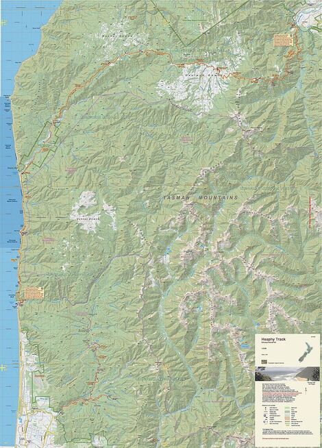
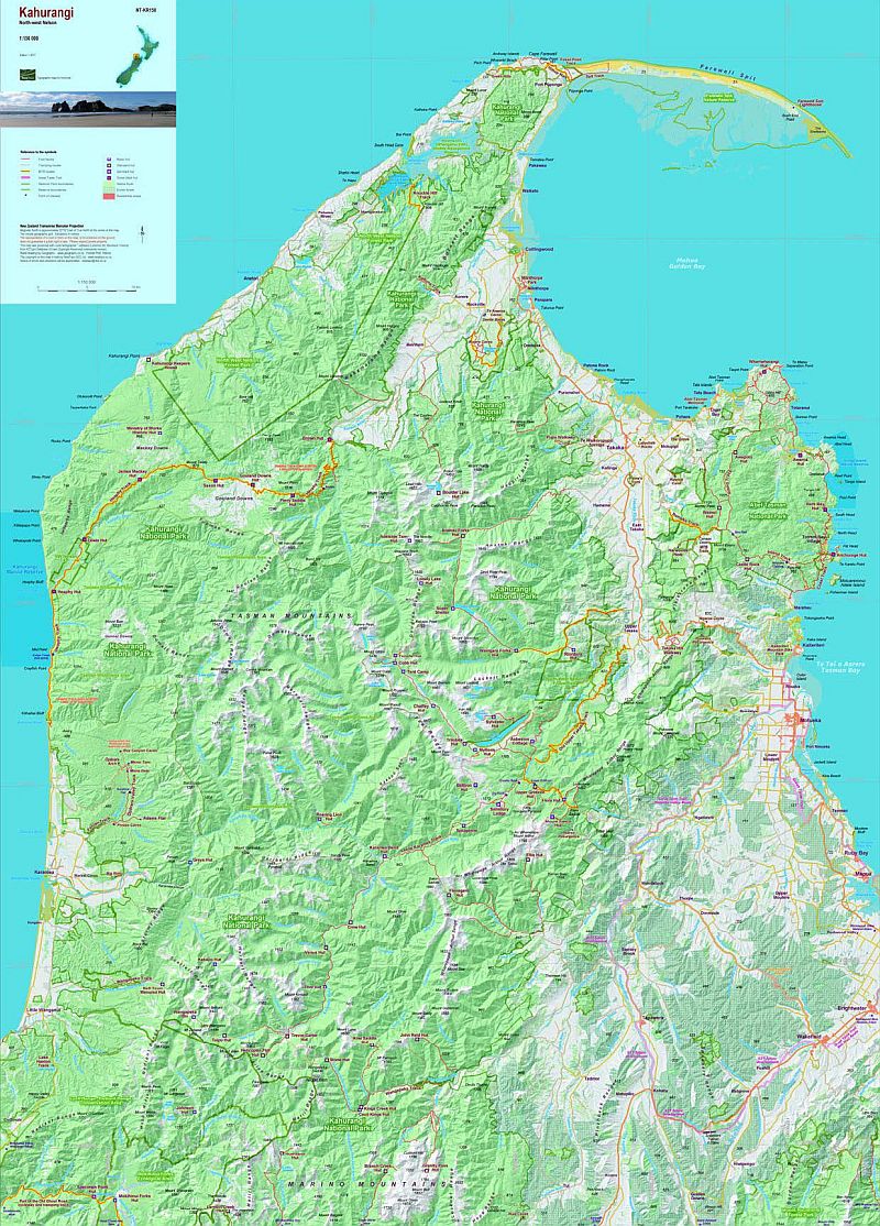
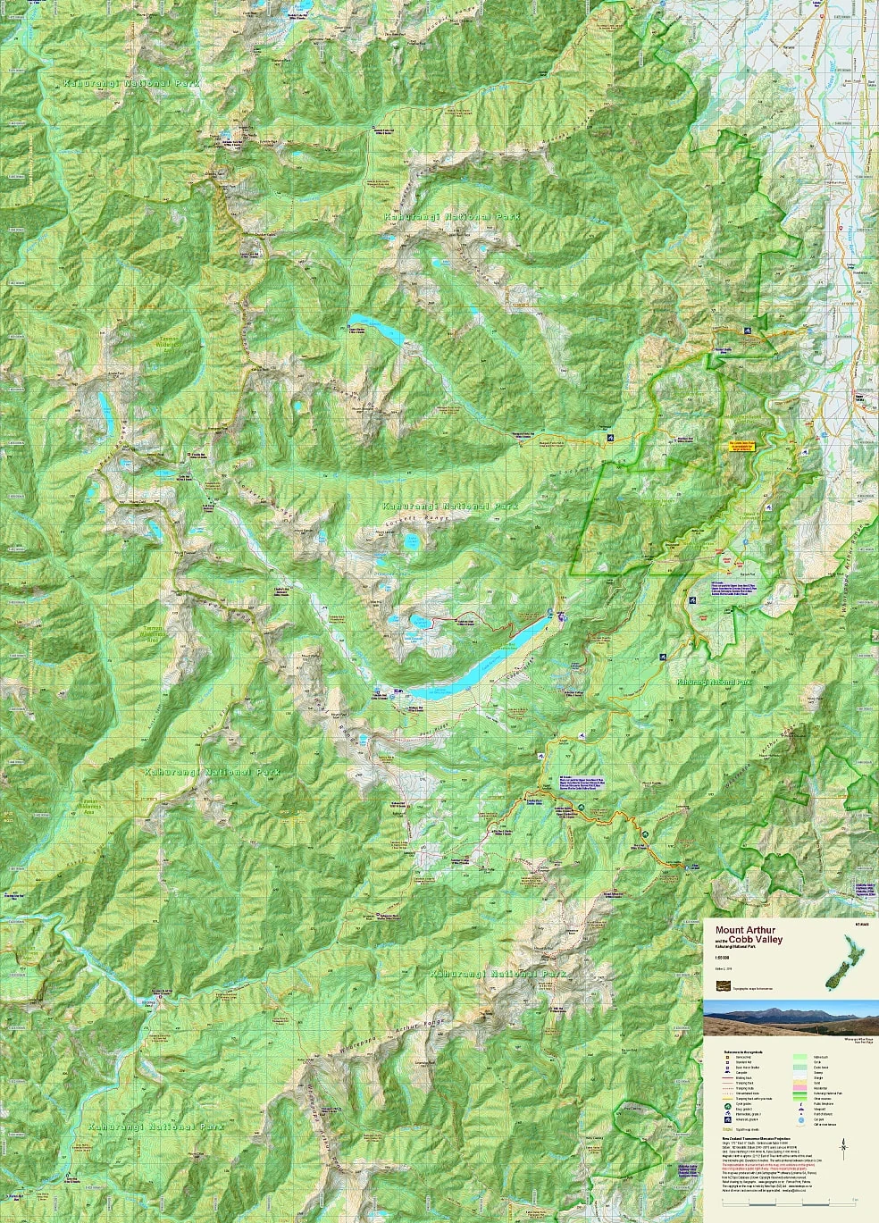
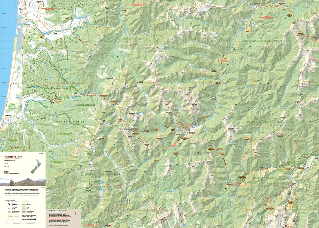
The Wangapeka Track crosses an isolated and complex mountain system in Kahurangi National Park, between the Waimea Basin near Tapawera south of Nelson, over two 1000m passes to the West Coast near Little Wanganui, south of Karamea.
This new edition has been extended northwards to provide overlaps with the Heaphy Track map to the north west and the Mt Arthur, Cobb Valley map to the north. There is a small overlap with the Old Ghost Road map in the south west.
The map now includes the Leslie-Karamea Track upstream from Karamea Bend to join the Wangapeka Track.
Note: The western end of the Wangapeka Track has been downgraded to tramping route status. All tracks require care at all times.
Edition 3, 2019. Scale 1:55 000
Technical Specs
- Large format 840x600mm
- Folded to 120x200mm
- 20m contours
- 1km grid
- 10 minute geographic graticule
- New Zealand Transverse Mercator projection
- Printed on 94gsm high wet strength paper
Original: $13.85
-70%$13.85
$4.15Product Information
Product Information
Shipping & Returns
Shipping & Returns
Description
Explore a rugged environment with this NZTopo map in Kahurangi National Park.
![]()
Overview
The Wangapeka Track crosses an isolated and complex mountain system in Kahurangi National Park, between the Waimea Basin near Tapawera south of Nelson, over two 1000m passes to the West Coast near Little Wanganui, south of Karamea.
This new edition has been extended northwards to provide overlaps with the Heaphy Track map to the north west and the Mt Arthur, Cobb Valley map to the north. There is a small overlap with the Old Ghost Road map in the south west.
The map now includes the Leslie-Karamea Track upstream from Karamea Bend to join the Wangapeka Track.
Note: The western end of the Wangapeka Track has been downgraded to tramping route status. All tracks require care at all times.
Edition 3, 2019. Scale 1:55 000
Technical Specs
- Large format 840x600mm
- Folded to 120x200mm
- 20m contours
- 1km grid
- 10 minute geographic graticule
- New Zealand Transverse Mercator projection
- Printed on 94gsm high wet strength paper