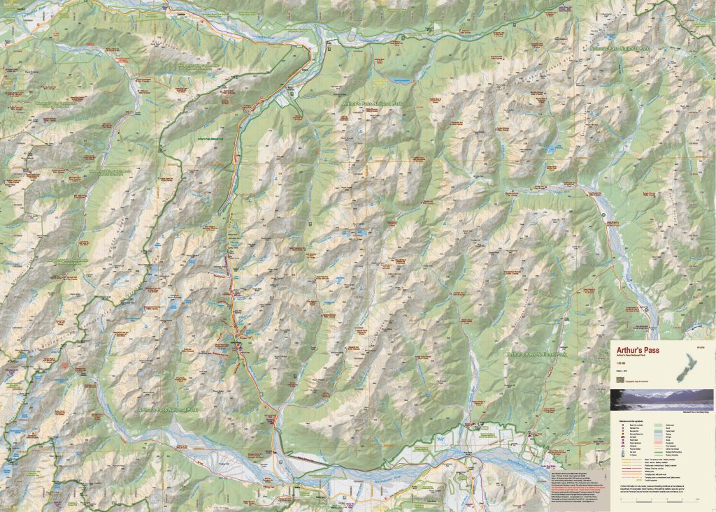
NewTopo - Arthur's Pass Topo Map
Climb and tramp your way through Arthur's Pass!
![]()
Overview
Arthur's Pass National Park has something for everyone – from easy tramps to difficult climbs and everything in between. This new map encourages exploration of a variety of geographic environments and the development of self-sufficiency.
This new edition shows the National Park and other reserve boundaries and is printed on Polyart waterproof synthetic paper.
Note: Casey Hut was burnt down in October 2015 but has been replaced by a new 12 bunk serviced hut in June 2020 on the Poulter River Flats just south of Casey Stream.
Edition 2 2018. Scale 1:55 000
Technical Specs
- Large format 840x600mm
- Folded to 120x200mm
- 20m contours
- 1km grid
- 10 minute geographic graticule
- New Zealand Transverse Mercator projection
- Printed on 90gsm Polyart waterproof synthetic paper
Product Information
Product Information
Shipping & Returns
Shipping & Returns
Description
Climb and tramp your way through Arthur's Pass!
![]()
Overview
Arthur's Pass National Park has something for everyone – from easy tramps to difficult climbs and everything in between. This new map encourages exploration of a variety of geographic environments and the development of self-sufficiency.
This new edition shows the National Park and other reserve boundaries and is printed on Polyart waterproof synthetic paper.
Note: Casey Hut was burnt down in October 2015 but has been replaced by a new 12 bunk serviced hut in June 2020 on the Poulter River Flats just south of Casey Stream.
Edition 2 2018. Scale 1:55 000
Technical Specs
- Large format 840x600mm
- Folded to 120x200mm
- 20m contours
- 1km grid
- 10 minute geographic graticule
- New Zealand Transverse Mercator projection
- Printed on 90gsm Polyart waterproof synthetic paper