NewTopo - Kahurangi Topo Map
Plan your next epic with this large scale map.
![]()
Overview
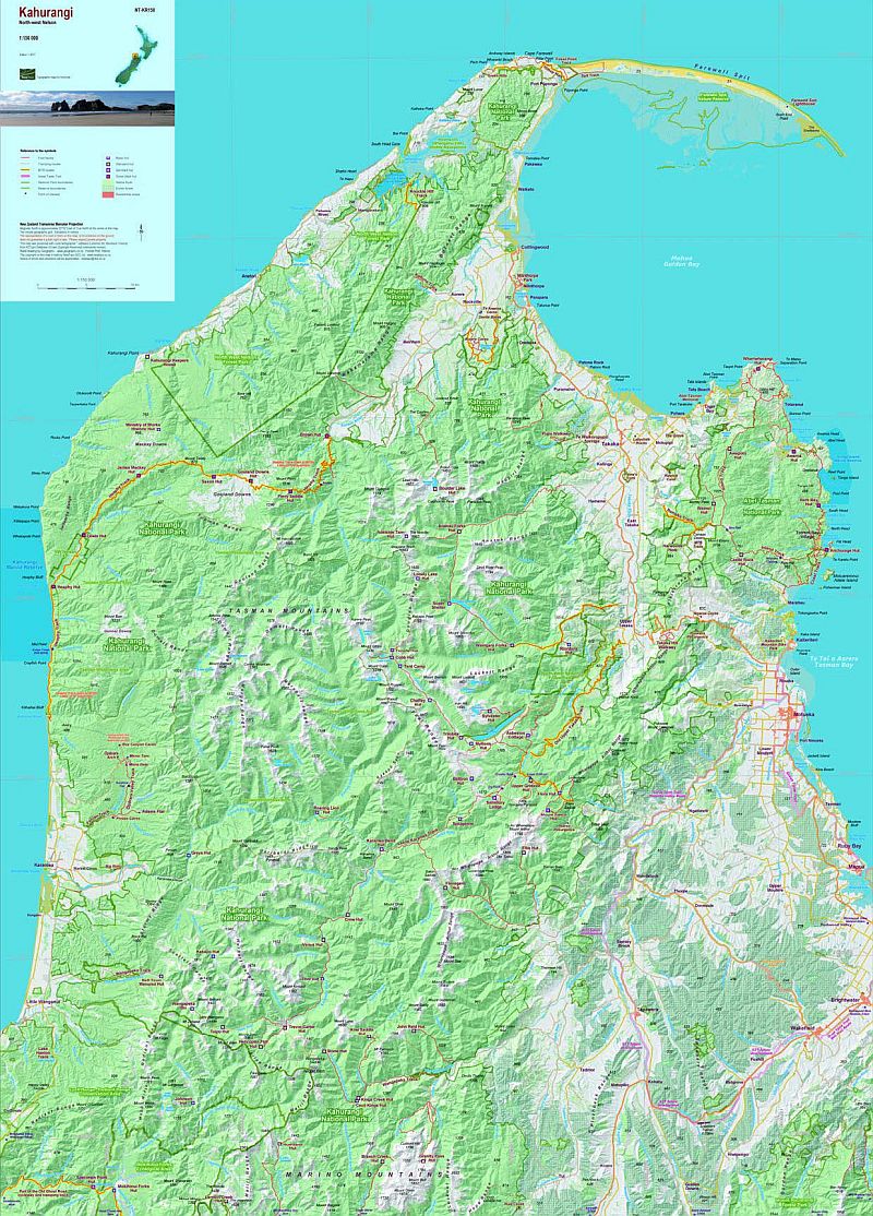
Designed as a wall map for planning tramping trips and excursions in north-west Nelson, this map shows the bulk of Kahurangi National Park and other conservation reserves between Karamea in the west, Able Tasman National Park in the east. Cape Farewell in the north, and the Mokihinui River and Mount Owen in the south.
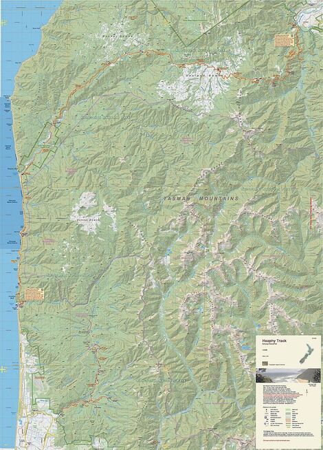
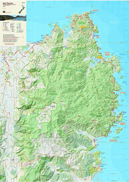
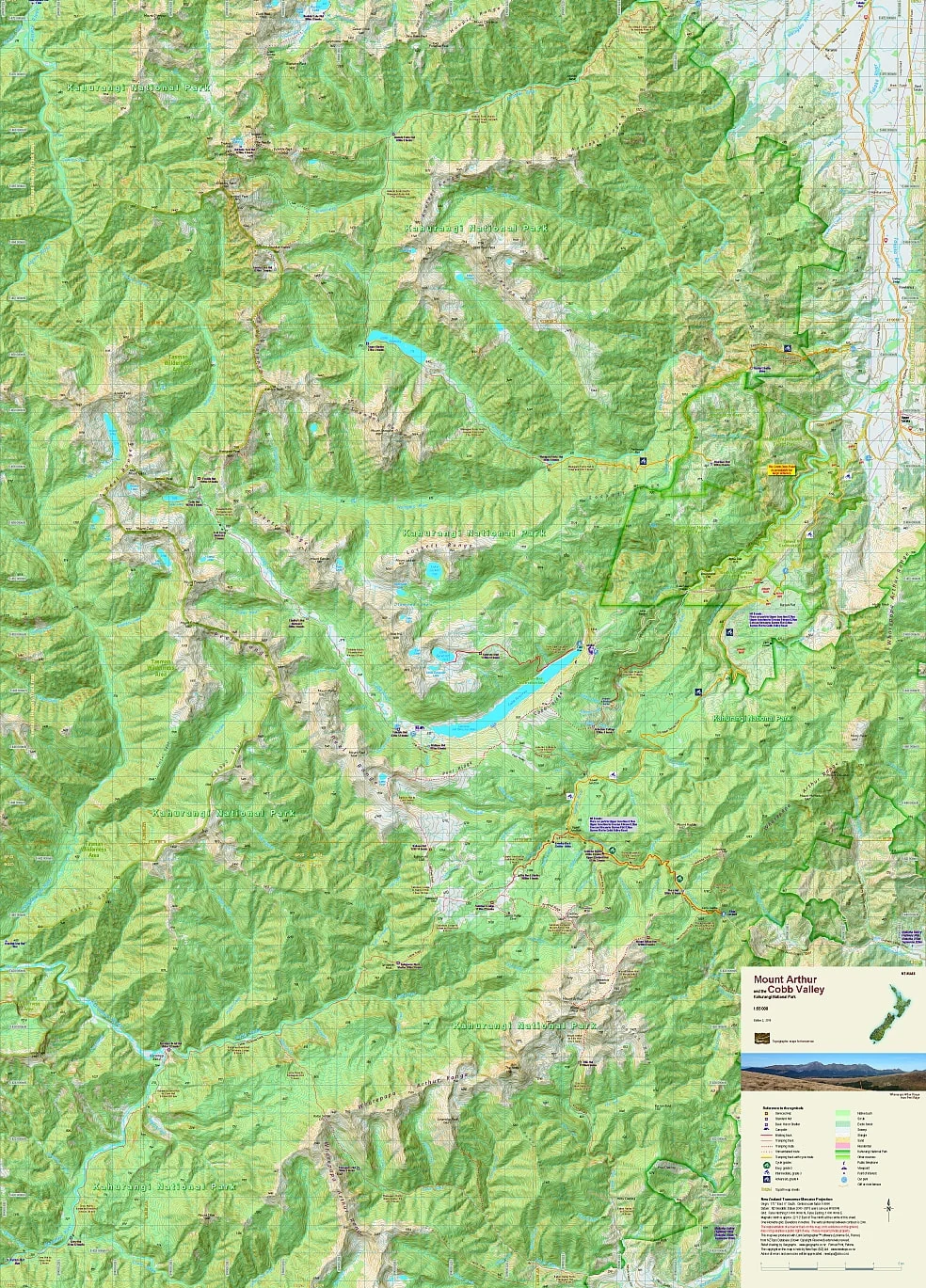
The positions of the main tramping tracks, tramping routes, and huts are prominent, as are the Abel Tasman Coast and Inland Tracks, the Heaphy Track, the Wangapeka Track, the Mount Arthur Tableland, the Cobb Valley, the Mokihinui end of the Old Ghost Road, and all the tracks in between.
The boundaries of Kahurangi National Park, and other reserves, are shown in a way that does not dominate the landform. In the eastern part of the map, the route of the western part of Nelson’s Great Taste Trail is included.
The Kahurangi map covers at a small scale areas covered by the Abel Tasman map (1:40 000), Golden Bay map (1:60 000), Mt Arthur, Cobb Valley map (1:55 000), Heaphy Track map (1:55 000), and Wangapeka Track map (1:55 000).
Edition 2, 2017. Scale 1:150 000
Technical Specs
- Large format 840x600mm
- Folded to 120x210mm
- 20m contours
- 1km grid
- 10 minute geographic graticule
- New Zealand Transverse Mercator projection
- Printed on 90gsm Polyart waterproof synthetic paper
Product Information
Product Information
Shipping & Returns
Shipping & Returns
Description
Plan your next epic with this large scale map.
![]()
Overview
Designed as a wall map for planning tramping trips and excursions in north-west Nelson, this map shows the bulk of Kahurangi National Park and other conservation reserves between Karamea in the west, Able Tasman National Park in the east. Cape Farewell in the north, and the Mokihinui River and Mount Owen in the south.
The positions of the main tramping tracks, tramping routes, and huts are prominent, as are the Abel Tasman Coast and Inland Tracks, the Heaphy Track, the Wangapeka Track, the Mount Arthur Tableland, the Cobb Valley, the Mokihinui end of the Old Ghost Road, and all the tracks in between.
The boundaries of Kahurangi National Park, and other reserves, are shown in a way that does not dominate the landform. In the eastern part of the map, the route of the western part of Nelson’s Great Taste Trail is included.
The Kahurangi map covers at a small scale areas covered by the Abel Tasman map (1:40 000), Golden Bay map (1:60 000), Mt Arthur, Cobb Valley map (1:55 000), Heaphy Track map (1:55 000), and Wangapeka Track map (1:55 000).
Edition 2, 2017. Scale 1:150 000
Technical Specs
- Large format 840x600mm
- Folded to 120x210mm
- 20m contours
- 1km grid
- 10 minute geographic graticule
- New Zealand Transverse Mercator projection
- Printed on 90gsm Polyart waterproof synthetic paper